Why Marine Damage Assessment Is a Financial and Legal Necessity
Marine damage assessment is the structured process of evaluating, documenting, and quantifying physical or environmental harm to vessels, marine equipment, or coastal ecosystems following an incident such as a collision, grounding, fire, flooding, or oil spill.
Quick Answer: What Is Marine Damage Assessment?
- For Vessel Owners: A professional inspection documenting the extent, cause, and repair costs of damage to support insurance claims, legal disputes, or sale negotiations
- For Insurers: An objective third-party evaluation establishing actual cash value, replacement cost, and whether equipment can be repaired or must be replaced
- For Environmental Incidents: A federally mandated process (NRDA) that quantifies injury to natural resources like coral reefs or seagrass and holds responsible parties accountable for restoration
- Key Deliverables: Signed statements, photographic evidence, failure analysis, repair recommendations, and cost estimates
The distinction matters because not all marine damage assessments are the same. A grounding on a coral reef triggers a multi-agency Natural Resource Damage Assessment under federal law, while a collision between recreational vessels may require only a private surveyor’s report for insurance purposes. Both serve critical functions, but the scope, legal authority, and restoration obligations differ dramatically.
Consider that NOAA has helped recover over $10.4 billion to restore ecosystems damaged by pollution—a figure that underscores the financial and environmental stakes when marine incidents occur. For vessel owners, the cost of an undetected structural failure or improperly documented claim can mean the difference between a covered repair and a total loss.
Whether responding to a hurricane-damaged yacht, a commercial vessel grounding, or a fuel spill in protected waters, the assessment process follows a methodical sequence: initial response, field inspection, causation analysis, valuation, and final reporting. Advanced tools like thermal imaging and ultrasonic thickness gauging allow surveyors to detect hidden delamination or corrosion without destructive testing—essential for accurate estimates and insurance compliance.
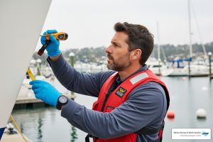
As Andrew Gallant, a SAMS-accredited marine surveyor and principal of Marine Surveys of North Carolina, I’ve conducted marine damage assessments across a range of incidents, from storm-related hull breaches to mechanical failures requiring litigation support. My work in marine damage assessment centers on delivering objective, well-documented findings that protect vessel investments and satisfy insurer and regulatory requirements.
 Incident occurs (collision, grounding, fire, spill), 2) Initial response and documentation (signed statements, photographs), 3) Field assessment (thermal imaging, ultrasonic testing, systems inspection), 4) Causation and failure analysis, 5) Valuation and repair recommendations, 6) Final report and claims support, 7) Restoration or repair implementation, 8) Monitoring and compliance verification - Marine damage assessment infographic infographic-line-3-steps-elegant_beige")
Understanding the Scope and Importance of Marine Damage Assessment
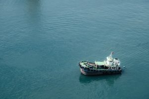
In the coastal waters of North Carolina—from the busy marinas of Wilmington and Morehead City to the challenging inlets of the Outer Banks—marine incidents are an unfortunate reality of life on the water. When a vessel is compromised, the primary goal of a marine damage assessment is to provide an objective, technical foundation for every decision that follows.
For vessel owners, this assessment is the shield that protects their financial investment. Without a professional survey, a “minor” grounding might mask structural delamination that compromises the hull’s integrity months later. For insurers, the assessment provides the data needed to determine liability and coverage, ensuring that claims are settled based on facts rather than estimates. Regulators, particularly in sensitive areas like the Florida Keys or our own protected North Carolina sounds, use these assessments to enforce environmental protections and mandate restoration.
Common causes of damage that we frequently evaluate include:
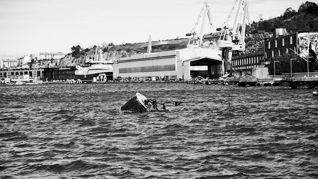
- Collisions and Allisions: Impact with other vessels or stationary objects like docks and pilings.
- Groundings: Often occurring in shallow coastal waters, leading to keel, rudder, and propulsion damage.
- Fire and Smoke: Requiring specialized analysis of structural weakening and soot contamination in mechanical systems.
- Flooding and Sinking: Assessing the viability of electrical systems and engine components after submersion.
- Environmental Incidents: Large-scale events like oil spills or hazardous material releases.
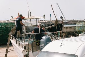
Professional Damage Surveys are essential because they move beyond surface-level observations. We examine propulsion, electrical, steering, and HVAC systems to quantify contamination and determine if equipment can be cleaned, repaired, or must be replaced.
Key Players and Specialized Assessment Programs
A comprehensive marine damage assessment often involves a collaborative effort between private experts and government agencies. In North Carolina, we work within a framework governed by both federal law and industry standards.
Key players often include:
- Private Surveying Firms: Like Marine Surveys of North Carolina, providing SAMS-certified inspections for private owners and insurers.
- NOAA (National Oceanic and Atmospheric Administration): Specifically the Damage Assessment, Remediation, and Restoration Program (DARRP).
- Government Trustees: Federal, state, and tribal agencies that act on behalf of the public to protect natural resources.
- Classification Societies: Organizations like the American Bureau of Shipping (ABS) that set technical standards for vessel safety.
For incidents involving environmental harm, the Natural Resource Damage Assessment (NRDA) process is the primary legal and scientific tool used to evaluate impacts. Unlike a standard boat survey, an NRDA focuses on “lost services”—such as the loss of a recreational fishing area or the destruction of a seagrass meadow—and ensures the public is compensated for these interim losses.
Rapid Response Programs and Marine Damage Assessment
For commercial operators and large-scale vessel managers, time is the enemy during an emergency. Programs like the ABS Rapid Response Damage Assessment (RRDA) provide 24/7 technical support. When a collision or grounding occurs, these teams use computerized shore-based programs to perform stability and residual structural strength calculations.
This is not just a best practice; for many, it is a legal requirement. Under MARPOL Regulation 1/37(4), oil tankers of 5,000 tonnes deadweight or more must have prompt access to these computerized programs. These tools allow engineers to simulate “what-if” scenarios, determining if a damaged hull can withstand the stresses of a tow or if a specific offloading sequence will cause the vessel to break apart.
The Role of Government Trustees in Large-Scale Incidents
When pollution strikes, the government steps in as a “trustee” for the environment. NOAA DARRP, along with state partners, conducts scientific studies that can take years to complete. These studies are designed to prove the extent of the injury in a court of law, ensuring that polluters, not taxpayers, foot the bill for restoration.
A prime example is the Deepwater Horizon incident, where the NRDA process was instrumental in securing billions for Gulf Coast recovery. In smaller, more localized North Carolina incidents, such as a vessel grounding in a protected sound, state trustees use similar methodologies to ensure that damaged seagrass or oyster beds are restored to their baseline condition.
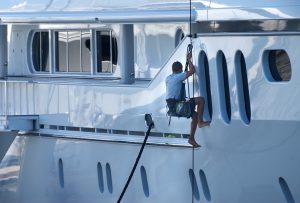
The Technical Process of a Marine Damage Assessment
Conducting a marine damage assessment is a methodical, step-by-step operation. We don’t just “look at the boat”; we dissect the incident to find the truth.
- Initial Response: Gathering incident particulars, including signed statements from the operator and witnesses.
- Field Assessment: A physical inspection of the hull, machinery, and systems.
- Causation Determination: Analyzing failure points to determine if the damage was a result of the incident or pre-existing wear and tear.
- Valuation: Establishing the Actual Cash Value (ACV) and Replacement Cost Value.
- Repair Recommendations: Providing a roadmap for returning the vessel to its pre-loss condition.
Understanding how to use a damage survey to identify necessary repairs can save owners thousands of dollars by preventing “scope creep” during the repair process and ensuring that insurance payouts are accurate.
Advanced Technologies in Marine Damage Assessment
Modern surveying has moved far beyond the “hammer and flashlight” era. At Marine Surveys of North Carolina, we use advanced non-destructive testing (NDT) to find what the naked eye cannot.
- Thermal Imaging (Infrared): This technology detects temperature variations that indicate moisture trapped in cored laminates or electrical “hot spots” in a damaged panel. After a hurricane or significant impact, infrared can reveal hidden delamination that would otherwise go unnoticed until a structural failure occurs.
- Ultrasonic Thickness Gauging: Used primarily on steel and aluminum vessels (like commercial fishing boats in Beaufort), this tool measures the remaining thickness of hull plating to ensure it meets safety standards.
- Computerized Stability Models: For larger yachts and commercial vessels, these programs calculate how water ingress affects the vessel’s center of gravity and righting arm.
Documentation and the Final Survey Report
The final output of a marine damage assessment is the survey report. This document is often used as a legal instrument in court or as the primary evidence for an insurance adjuster. A comprehensive report must include:
- Photographic Evidence: High-resolution images of all damaged areas, including serial numbers of affected components.
- Fact-Based Narrative: A clear explanation of what happened, when, and where.
- Cost Estimates: Detailed breakdowns of parts and labor required for repairs.
- Audit of Invoices: If repairs have already begun, we audit the shipyard’s invoices to ensure the work matches the documented damage.
Environmental Restoration and the NRDA Framework
While private surveys focus on the vessel, the Natural Resource Damage Assessment (NRDA) focuses on the water and the life within it. In areas like the Florida Keys National Marine Sanctuary, where hundreds of groundings are reported annually, the damage to coral and seagrass can be catastrophic.
Coral reefs, which may have taken centuries to grow, can be pulverized in seconds by a grounded hull. Seagrass meadows, vital for North Carolina’s fisheries, can suffer “prop scars” that never heal naturally. NOAA’s accomplishments in ecosystem restoration highlight the success of this framework, having recovered over $10.4 billion for restoration projects nationwide.
| Restoration Category | Primary Goal | Example |
|---|---|---|
| Primary Restoration | Return the resource to its “baseline” (pre-incident) condition. | Replanting seagrass or stabilizing broken coral heads. |
| Compensatory Restoration | Address the “interim loss” of resources from the time of injury until full recovery. | Creating a new oyster reef to compensate for lost fish habitat. |
| Emergency Restoration | Immediate actions taken to prevent further harm. | Removing a grounded vessel before it leaks fuel or grinds further into a reef. |
| Early Restoration | Restoration projects started before the full assessment is complete. | Building a public boat ramp while long-term bird habitat studies continue. |
Restoration Categories and Implementation
The goal of any environmental marine damage assessment is to achieve “baseline” condition. If a vessel leaks fuel into a North Carolina marsh, primary restoration involves cleaning the soil and replanting native grasses. However, because those grasses might take five years to provide the same level of habitat as before, compensatory restoration might require the responsible party to fund additional conservation projects elsewhere to make the public “whole.”
Regulatory Compliance and Risk Mitigation for Vessel Owners
Navigating the legal waters of marine incidents requires an understanding of several key frameworks. Compliance is not just about avoiding fines; it’s about ensuring your vessel remains insurable and legally compliant.
- MARPOL 73/78: The international convention for the prevention of pollution from ships.
- SOPEP (Shipboard Oil Pollution Emergency Plan): Required for all tankers over 150 gross tons and other vessels over 400 gross tons. This plan outlines exactly how a crew must respond to a spill.
- National Marine Sanctuaries Act (Section 312): This provides the legal authority for NOAA to seek damages for injuries to sanctuary resources.
- ISM Code: The International Safety Management Code, which mandates safe practices in ship operation.
Best Practices for Risk Mitigation:
- Maintain Professional Records: Keep up-to-date surveys and maintenance logs.
- Navigation Preparation: Always use current nautical charts and monitor tides, especially in shifting North Carolina inlets.
- Emergency Response Plans: Know who to call (and have your surveyor’s number ready) before an incident occurs.
- Visibility: Use polarized sunglasses to better “read” the water and identify shoals or submerged hazards.
Frequently Asked Questions about Marine Damage Assessment
What should be included in a comprehensive marine damage survey report?
A professional report must include a detailed cause and scope of damage, a structural assessment of the hull, a check of all mechanical and electrical systems, and repair recommendations. It should also include a valuation adjustment to reflect the vessel’s value post-incident. At Marine Surveys of North Carolina, we ensure our reports are concise, professional, and ready for use by insurers or legal counsel.
How does Natural Resource Damage Assessment (NRDA) work for environmental impacts?
NRDA is a legal and scientific process. It begins with a preliminary assessment to determine if injuries occurred. If they did, trustees conduct scientific and economic studies to quantify the injury and the loss of public use. The final phase is the implementation of a restoration plan, which is often funded by the party responsible for the damage.
How can vessel owners prevent groundings and prepare for assessments?
Preparation is the best defense. Familiarize yourself with local waters, use up-to-date charts, and always stay in marked channels when available. To prepare for an assessment, keep all vessel documentation, previous survey reports, and maintenance receipts in a secure, accessible location. This provides a “baseline” for the surveyor to work from.
Conclusion
Whether you are dealing with a minor dock strike in Lake Norman or a complex structural claim on the Outer Banks, marine damage assessment is the only way to ensure your interests are protected. At Marine Surveys of North Carolina, we provide the SAMS SA certified expertise and unbiased professional analysis required to steer these difficult situations.
We understand that a damaged vessel is more than just a financial asset; it’s a significant part of your life and your passion. Our goal is to provide the clarity and documentation you need to make informed decisions, secure your insurance benefits, and get back on the water safely.
If you have experienced a marine incident or need to document your vessel’s condition for insurance purposes, we invite you to request a professional insurance survey today. Let our experience be your guide in protecting your maritime investments.